3.2 - Habitat Analysis
Habitat analysis ensures your habitat classifications are scientifically robust and audit-ready. This is achieved by verifying and editing the "Features" from the sampling plan against actual field evidence (ground truth data & satellite data) and completing survey forms per habitat parcel to accurately assess habitat type and condition
3.2.1: Reviewing Ground-Truth Data
Before completing any assessments you must review the evidence collected at each checkpoint.
-
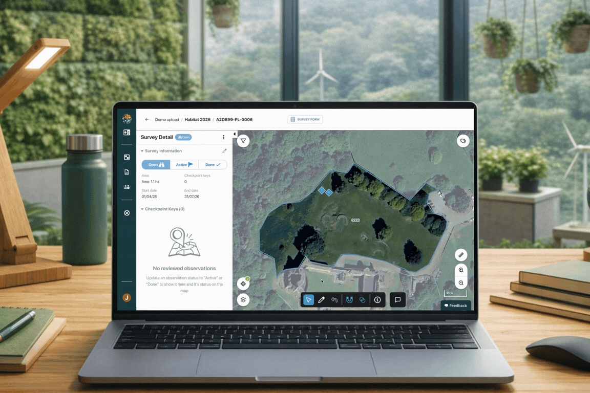
Select a Polygon: Select a parcel from the survey list (each feature has a unique Mozaic ID for tracking / auditing purposes)
-
View Checkpoints: Once selected, all checkpoints containing ground-truth data will appear on the map. Click on individual checkpoints to view the images collected at these locations.
-
Inspect Tasks: Use the top-left menu to toggle between different tasks completed at the same location to gain a comprehensive view of the area.
-
Labelling: Use the toolbar beneath each image to label key features as you go through them.
\
3.2.2: Refining Habitat Boundaries
Utilise the Mapping Tools to ensure polygon boundaries match the reality seen in field photos and satellite views.
Visual Alignment:
-
Ground truth data - Review all checkpoints to ensure you have the best understanding of the site.
-
Context Layers - Toggle context layers on and off from the menu in the bottom-left corner to compare your polygon boundaries with satellite data.
- Requesting Layers- If you require additional context layers to be added, please contact Johanna at johanna@mozaic.earth.
Editing features:
-
Use the toolbar located on the bottom of the screen to edit polygons.
-
Click the pencil icon to edit features
-
Move the boundary by dragging the points on the map to the new location
-
Delete points as needed to ensure you have a clean boundary
-
Once you are happy with the edited boundary, click the edit button again to finalise
-
Precision Tools: Utilise the Snapping Tool to ensure no gaps exist between adjacent polygons
-
Split and Merge tools can also be used to refine multiple features based on field evidence.
💡 Pro Tip: To learn more in-depth about the mapping tools available on the dashboard, click this link 👉 \
3.2.3: Condition Forms
After the geometry is correct, you must complete the habitat condition forms.
-
Add Survey Form: Click the Survey Form button at the top of the page and choose the relevant framework, such as BNG (Biodiversity Net Gain), GBM (Global Biodiversity Metric), or ABM (American Biodiversity Metric).
-
Classify Habitat: Select the Broad and Specific habitat types based on your verified evidence.
-
Determine Condition: Answer the habitat-specific questions and add supporting / justification notes on the form to generate the final condition score.
-
Progress tracking: Mark the polygon as Complete and continue through all the map features until the site is finished.