2.2 - Data Collection
When you are in the field and ready to start your data collection, head to the app and select the project. This will display the checkpoint map, Checkpoints are individual GPS waypoints defined in the sampling strategy to guide your monitoring. Within each checkpoint are tasks to be completed to collect ground truth data, the app will walk you through this in the field.
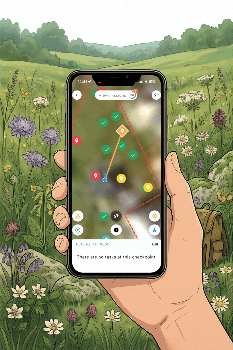
2.2.1 - Checkpoints 
Checkpoints are locations pre-defined by the projects sampling plan where data is to be collected from
-
Selection: Tap a checkpoint to select, the icon will change to an orange triangle when selected
-
Distance: The app will display your distance from the point in meters and automatically suggest the closest checkpoint to save you time.
-
Navigation: Your current location is visible on the map. Use the built-in compass to orient yourself towards the checkpoint.
-
Targeting: Stick as close to these locations as possible to ensure data reliability.
-
Tolerance: Aim to collect data within 15 meters of the checkpoint to maintain the integrity of the sampling plan.
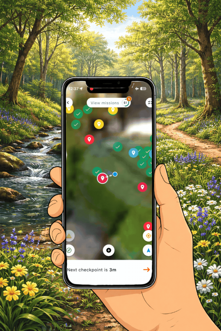
How to select a checkpoint and navigate to the checkpoint location on the Mozaic Earth app.
2.2.2 - Tasks
Once you have reached the checkpoint, you can complete the tasks at that location, each checkpoint contains one or more Tasks (e.g. 360° photos, quadrats, or sensor installs).
-
Open task: select the orange camera icon to begin

-
Capture: Rotate your phone to landscape mode and follow the step-by-step on screen instructions for the task.
-
Quality check: Ensure images are clear and in focus before clicking submit. High quality data is essential for accurate analysis.
-
Progress Tracking:
-
Task Complete: Once a task is finished, the task icon will change to a green tick to track progress

-
Checkpoint Complete: When all tasks at a checkpoint are complete, the checkpoint icon on the map turns to a green tick

-
-
Efficiency: After completion, the app will recommend the next closest checkpoint. You can follow this recommendation or manually select your next target from the map:
-
Continue to complete all the checkpoints until all the field work is completed


Example of the different task types that you could be asked to complete via the app. \
2.2.3: Safety & Accessibility
Field safety is the priority. If a checkpoint is located in a hazardous or inaccessible area (e.g. deep water, steep terrain):
-
Do not enter the unsafe area.
-
Select the Inaccessible Icon:
-
Collect the data from the nearest safe location to ensure ground-truth metrics are still captured where it is possible.
Record an inaccessable checkpoint on the app